Do you want the ease of city access without the daily car grind? In San Carlos, you can get around more by foot, bike, and Caltrain while keeping your options open. If you value shorter errands, outdoor dining, and a smoother commute, this guide shows how car-light living works here today and what upgrades are in the pipeline. You will learn how the station anchors daily life, which streetscape projects are advancing, and practical tips to make it all work. Let’s dive in.
Why San Carlos works for car-light living
San Carlos centers daily life around its Caltrain station, which sits at El Camino Real right by downtown. Caltrain’s destination guide even tags it as the stop for shopping and dining in “Downtown San Carlos,” so your first and last mile is often just a short stroll. That one-block relationship makes errands on Laurel Street feel natural after a train ride. It is a simple setup that reduces stress and makes a car-light routine realistic for many households.
The city is also acting on plans to make downtown more walkable and bike-friendly. The Downtown Streetscape Master Plan is advancing concepts like pedestrianizing part of Laurel Street, widening sidewalks, creating curbless plazas, adding bike parking, and designing Harrington Park improvements. Protected bike lanes on San Carlos Avenue and El Camino Real are part of the plan concepts. Together, these moves support a lifestyle that does not depend on a car for every trip.
Caltrain: your regional backbone
Where the station sits and why it matters
The San Carlos Caltrain station is the primary transit anchor for downtown, set at El Camino Real by the historic depot and modern platforms. Caltrain’s destination materials identify the stop as the gateway to shopping and dining downtown, which sits essentially a block to the west. That proximity turns the station into a dependable hub for commuting and for quick errands on foot.
- Learn more about the station’s downtown role on Caltrain’s shopping and destinations page: Downtown San Carlos by Caltrain
- Read about the station’s historic depot: San Carlos depot overview
What the 2024 electric rollout means
Caltrain completed its electric service rollout in 2024 and followed with a new schedule across the San Francisco to San Jose corridor. Riders benefit from more frequent and more reliable trains, especially during core weekday times when locals often travel. In practice, that makes planning a door-to-door trip to major job centers much easier.
- Get background on the electric service launch: Caltrain electric train overview
Tip: always check the current weekday timetable before a commute-time test ride, since service updates roll out periodically.
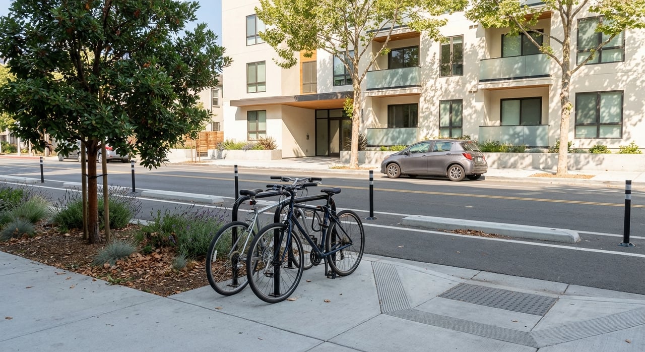
Bikes + Caltrain: secure options at the station
If you like the bike-plus-train combo, the San Carlos station supports it. Caltrain lists e-lockers and multiple rack spaces on site, so you can lock up securely or park for a short stop. That makes it easy to ride from home, store your bike, and continue by rail.
- See station bike parking details: Caltrain bike parking options
Walking downtown: one-block convenience
Downtown San Carlos sits immediately west of the station. Laurel Street and the Harrington Park area hold a dense mix of cafés, casual dining, services, and pocket plazas. From the platform, you are only a few minutes on foot from a coffee, a quick lunch, or a pharmacy stop.
The city’s Downtown Streetscape Master Plan is shaping this area for more comfortable walking and outdoor time. Current design work includes:
- A pedestrian-first plan for the 700 block of Laurel Street
- Wider sidewalks with curbless plaza spaces and outdoor dining zones
- Added bike parking and upgrades to Harrington Park, including a pavilion and water feature
- Protected bike lane concepts across core downtown streets, such as San Carlos Avenue and El Camino Real
You can review design images and meeting notes here: San Carlos Downtown Streetscape Master Plan
Biking made easier
Protected bike lanes in design
Two efforts point to lower-stress biking ahead. First, the Downtown Streetscape Master Plan includes protected bike lane concepts in the downtown core. Second, the county-led Grand Boulevard Initiative and the SamTrans Central El Camino planning effort are studying multimodal upgrades and potential protected bikeways along El Camino Real. These are active planning and outreach efforts, not finished construction, but they signal a clear direction toward safer bike connections.
- Read about the corridor vision: Grand Boulevard Initiative
- Track the current outreach and design steps: Central El Camino project
Weekend rides and scenic loops
A short bike ride opens up easy recreation. The Peninsula’s Bay Trail segments and the waterways near Redwood City, including Bair Island, offer flat, scenic routes that work well for a Saturday spin. For route ideas and photos in the area, check this local resource that showcases Redwood City waterfront paths and views: Redwood City waterfront and trails overview
Everyday errands without the car
You can handle a surprising share of errands on foot or by bike within the station-to-Laurel Street footprint. Here is what a typical car-light week can look like:
- Quick groceries: Trader Joe’s sits on El Camino Real in San Carlos, which makes pantry top-ups or midweek produce runs simple. For full weekly shops, you may still prefer a car or e-bike. Check the store page for address and hours: Trader Joe’s San Carlos
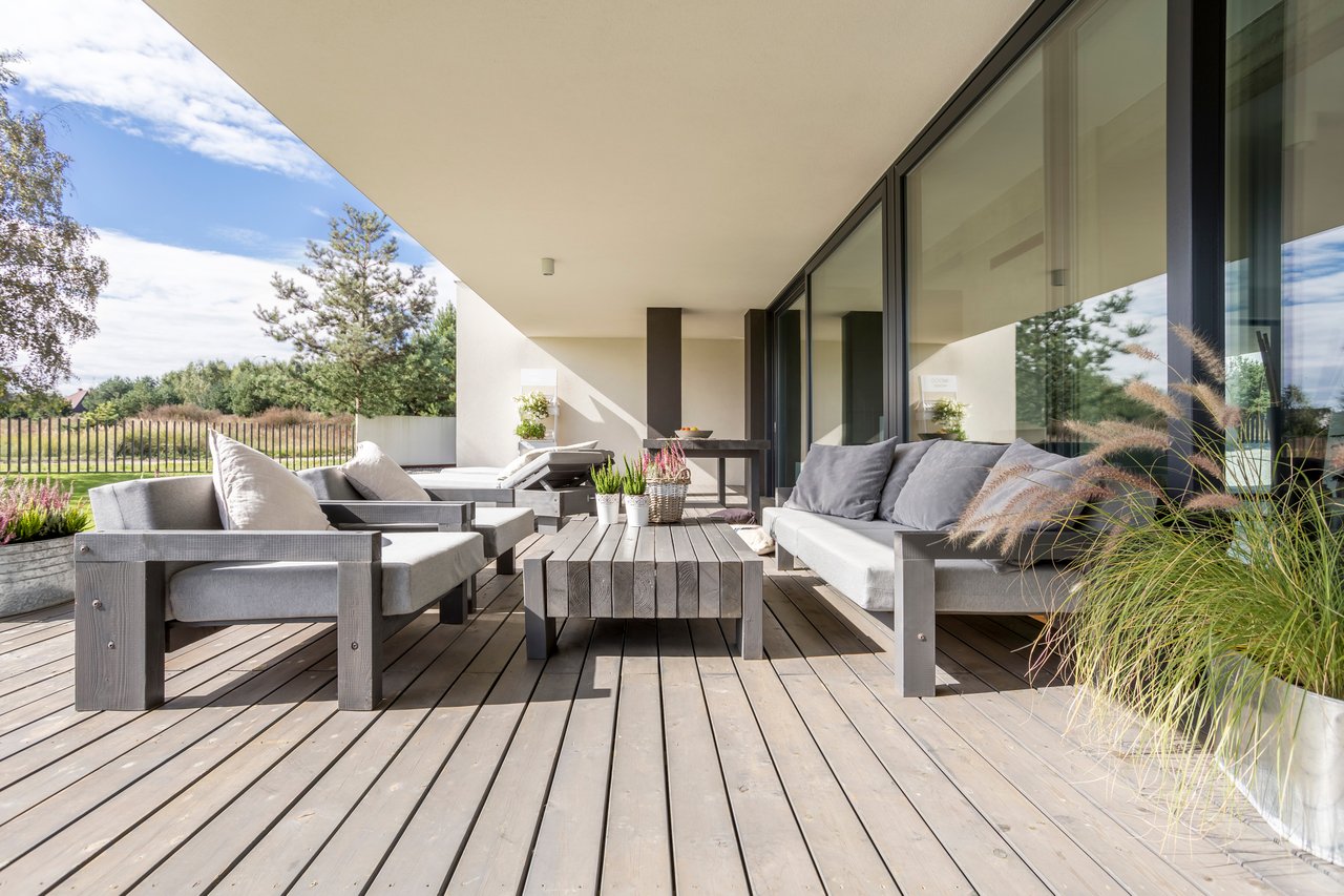
- Coffee and casual dining: Laurel Street’s cafes and eateries are a short walk from the platform. The city’s streetscape plan prioritizes outdoor dining and wider sidewalks, which create more room to linger and meet up.
- Services: Banks, pharmacies, dry cleaners, salons, and small clinics are typical downtown tenants. Most are a few minutes by foot or a short bike hop from the station area. When you need a specific location or hours, check directly with the business.
- Station-adjacent stops: The historic depot area has hosted small station retail, which makes pre- or post-train pick-ups convenient. Learn more about the depot here: San Carlos depot overview
What’s changing next
San Carlos and regional partners have several efforts to watch if you value car-light living:
- Downtown Streetscape actions: Pedestrianizing part of Laurel Street, widening sidewalks, curbless plazas, added bike parking, Harrington Park upgrades, and protected bike lane concepts are moving through design and public meetings. See the latest materials: San Carlos Downtown Streetscape Master Plan
- Central El Camino planning: SamTrans and local partners are running a multimodal corridor study with outreach through 2026 that could improve bus stops and bike comfort on El Camino Real. Track updates here: Central El Camino project
- Caltrain service since electrification: The 2024 shift to electric trains increased frequency and reliability along the core corridor, which supports a less car-dependent routine for commuters. Get background here: Caltrain electric train overview
Tips to go car-light faster
Use these simple steps to make a car-light lifestyle stick in San Carlos:
- Map your 10-minute walk: Choose a home that sits within a 10-minute walk of the station or Laurel Street. The one-block station-to-downtown relationship is a daily time-saver.
- Test your commute: Do a round-trip on Caltrain during your typical weekday times. Check the current timetable and note transfer windows you want to hit.
- Add an e-bike: A 5 to 10 minute e-bike ride multiplies your errand radius. Pair it with station e-lockers or racks for bike-plus-train trips.
- Batch errands: Plan a weekly loop that combines a pharmacy stop, a bank visit, and a coffee, all on foot. You will save time and skip parking searches.
- Watch project updates: Follow the Downtown Streetscape and Central El Camino pages for phasing and construction news. Early awareness helps you adapt routes during changes.
- Use station amenities: If you park a bike at the station often, set up access for e-lockers and carry a good lock for open racks.
Ready to explore homes that fit a car-light lifestyle?
If you want a home that makes walking to Caltrain and downtown your new normal, let’s talk about neighborhoods, budgets, and timing. As a local, bilingual advisor with a financial-first approach, I will help you weigh convenience, commute options, and long-term value. Start with a quick plan for the areas that fit your routine and budget, then tour homes that put you close to the station and Laurel Street. To get started, connect with Daniel Fridman today.
FAQs
Is San Carlos walkable for Caltrain commuters?
- Yes. The station sits next to downtown, and Caltrain identifies it as the stop for shopping and dining in “Downtown San Carlos,” so many errands are a short walk from the platform. See: Caltrain destinations
How did Caltrain’s 2024 electric service change things?
- The 2024 rollout brought more frequent and more reliable service on the San Francisco to San Jose corridor, which makes door-to-door planning easier for a car-light commute. Learn more: Caltrain electric overview
Where can I lock my bike at the San Carlos station?
- Caltrain lists e-lockers and multiple rack spaces at the station, supporting bike-plus-train commutes and quick errands. Details: Caltrain bike parking options
What upgrades are planned for downtown streets in San Carlos?
- The Downtown Streetscape Master Plan includes pedestrianizing part of Laurel Street, wider sidewalks, curbless plazas, Harrington Park upgrades, and protected bike lane concepts. See updates: Downtown plan materials
What is the Central El Camino project and why does it matter?
- SamTrans and partners are running a multimodal corridor study with outreach through 2026 that explores transit improvements and potential protected bikeways on El Camino Real, which could improve bus and bike comfort. Project page: Central El Camino
Are there nearby leisure rides for families or beginners?
- Yes. The Redwood City waterfront and Bay Trail areas, including Bair Island, offer flat, scenic options within a short bike ride from San Carlos. Explore photos and routes: Redwood City waterfront trails